Monday, August 31, 2020

Thetis Island - Preedy Harbour Beach

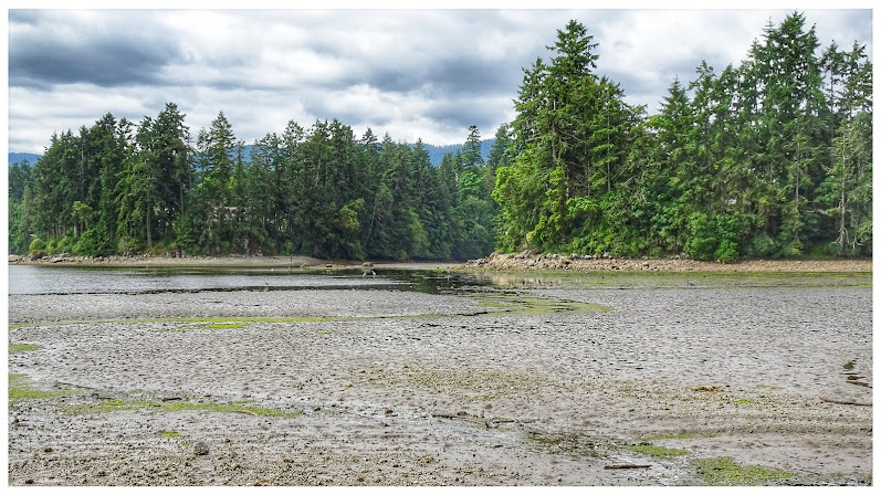
Years ago I'd been to Thetis Island with AAS and LS. HSR had never been. On this particularly overcast June day (2017-06-19) we caught the ferry in Chemainus and headed for the island. After a day of exploring the island (and checking out more beaches) we were back at the island ferry terminal in Preedy Harbour. While waiting for the ferry, we explored the beach.

Beach at Preedy Harbour (2017-06-19)

Looking at the Preedy Harbour ferry terminal (2017-06-19)

The beach at Preedy Harbour, seen from the ferry...

One of several summer camps on Thetis Island...


Sunday, July 16, 2017

Beach at Mill Bay Nature Park

As far as beaches go, this one is pretty small. A look through Theo Dombrowski's excellent Secret Beaches series took us to Mill Bay Nature Park (2017-06-11). Let's begin by saying, the park is well worth a stroll; especially cool and pleasant in the shade of the dense forest. Now, as far as beaches are concerned, this is not one for the kids or those who like to laze about on towels taking in the sun. If, however, the kids like turning over rocks, discovering tiny crabs or other squiggly maritime creatures, then this beach is ideal. Let's sum up this beach with "rocks"; with clams, oysters, and all sorts of shore birds.

A low tide at the beach at Mill Bay Nature Park...

One way to sum up this beach at Mill Bay is: ROCKS...


The beach is rich in shellfish...

Sunday, February 21, 2016

Wickaninnish Beach in November

If ever there was a "go-to" place for Hanne and me, it surely would be Long Beach on the west coast of Vancouver Island. We love beaches, and this area is not short of these. We'd be hard-pressed to name a favourite, as they all have features that recommend them. I love Florencia Bay, but I'd have to add; the north end not the south. The walk (perhaps it almost qualifies as a hike) to Schooner Cove, never mind the beach, is pretty awesome.

Wickaninnish Beach is perhaps the longest and most uninterrupted of the Long Beach strands. That is surely a positive feature. It's also the "closest" beach for those travelling from outside this region. When there's time for only one beach, proximity might make this the one.

In November of 2015 we checked into the Water's Edge Hotel in Ucluelet and began our exploration of Long Beach. On November 21, we arrived at Wickaninnish beach bright and early. The sun was out, and a little frost glistened on the low tide sands.

The November tides had left the strand a tad messy.  Exactly what Hanne like for her beachcombing (2015-11-21)
The November tides had left the strand a tad messy.
Exactly what Hanne like for her beachcombing (2015-11-21)

Contrast (2015-11-21)

As usual, Long Beach features plenty of driftlogs (2015-11-21)

Flotsam and jetsam (2015-11-21)
 Flotsam and jetsam (2015-11-21)

As usual, tangles of bullkelp (2015-11-21)

Vast stretches of sand (2015-11-21)

Thursday, September 26, 2013

Sandwell Provincial Park on Gabriola Island

Norbi's fate, had he stayed home, was shopping. And, likely, more shopping! Fortunatlely I came to his rescue.

My alternative to shopping was a day checking out as many beaches - with lunch and beer in between - as possible on Gabriola Island. After stops at Brickyard Beach, Degnen Bay, Drumbeg Park, and the pub at Silva Bay, we made our way to Sandwell Provincial Park. The rains of the previous evening had created a bit of a slick path to the beach (it should be mentioned, that this path is 650 meters long and quite steep) but we were down at sea level in no time at all.


Dombrowski: "...more than a kilometre long... mostly composed of a band of beach logs and fine pebbles leading, at low tide, to a wide stretch of fine, firm sand and tidal pools."(2013-06-01)
Dombrowski: "...more than a kilometre long... mostly composed 
of a band of beach logs and fine pebbles leading, at low tide, 
to a wide stretch of fine, firm sand and tidal pools."(2013-06-01)

The beach, #15 (page 57) in Theo Drombowski's "Secret Beaches of the Salish Sea" is, to quote Dombrowski, "...more than a kilometre long... mostly composed of a band of beach logs and fine pebbles leading, at low tide, to a wide stretch of fine, firm sand and tidal pools."

The south end of Sandwell Beach is rocky (2013-06-01)
 The south end of Sandwell Beach is rocky (2013-06-01)

This beach truly is a gem. But for the rather long and steep path leading to and from it, Sandwell Park beach is close to perfect!

South end of Sandwell Beach (2013-06-01)

Amidst the large boulders at the south end of the  beach at Sandwell Park; fine sand (2013-06-01)
Amidst the large boulders at the south end of the 
beach at Sandwell Park; fine sand (2013-06-01)

Looking south along the beach at Sandwell Park (2013-06-01)


Wednesday, September 25, 2013

Sandstone Beach along Jack Point

In Theo Dombrowski's excellent, must-have, book on "secret beaches", the Biggs and Jack Point Park beach is listed as #62 on page 165 (Secret Beaches of Southern Vancouver Island). To cite Dombrowski, "there are plenty of options for curling up in a sandstone basin, perching atop a sandstone couch or peering into tidal pools."

In a word, this beach is all about sandstone. Although there are plenty of examples of sandstone beaches on southern Vancouver Island and the Gulf Islands, this one at Jack Point has perhaps the biggest concretions I've seen in the area. Of course, there are plenty of examples of the tripe-like erosions here as well.

 Large concretions on a sandstone beach (2012-10-17)
 Large concretions on a sandstone beach (2012-10-17)

Trip-like sandstone erosions (2012-10-17)

A continuation of the sandstone formations on the other side of the little bay (2012-10-17)
 A continuation of the sandstone formations on the other side of the little bay (2012-10-17)


Sandstone beach details  (2012-10-17)
Sandstone beach details  (2012-10-17)

Friday, September 13, 2013

Departure Bay Details: a Stroll in October

Around mid-October, with a reasonably low tide (after having been turned back by high water in the past, I have learned to check this out), I thought I'd take a stroll along the Departure Bay beach, from the access point near the end of White Eagle Terrace, to the Kin Hut. The foliage showed off bright autumn colours. What struck me on this walk, was the amount of stuff, rusty and otherwise, I encountered. What follows are some impressions. Enjoy!

Autumn colours liven up a rocky Departure Bay beach (2012-10-14)
Autumn colours liven up a rocky Departure Bay beach (2012-10-14) 

Oh Canada! Maple leaf on a rocky beach (2012-10-14)
Oh Canada! Maple leaf on a rocky beach (2012-10-14) 

Might this have been part of a float in earlier days? (2012-10-14)
Might this have been part of a float in earlier days? (2012-10-14) 

Rusty remnants of another era (2012-10-14)
Rusty remnants of another era (2012-10-14) 

Autumn foliage covers the beach around the high water mark (2012-10-14)
Autumn foliage covers the beach around the high water mark (2012-10-14) 

Rusty stuff; a reminder of bygone eras (2012-10-14)
Rusty stuff; a reminder of bygone eras (2012-10-14) 

Too many colours to resist taking a picture (2012-10-14)
Too many colours to resist taking a picture (2012-10-14) 

In the distance, the Nanaimo oceanographic research facility (2012-10-14)
In the distance, the Nanaimo oceanographic research facility (2012-10-14)

More rusty stuff. Mining? Logging? Marine? Who knows? (2012-10-14)
More rusty stuff. Mining? Logging? Marine? Who knows? (2012-10-14) 

Wednesday, August 7, 2013

Rathtrevor Beach by Parksville


Rathtrevor Beach, near Parksville BC, is one of those beaches that will have you coming back over and over.

Acres of beachcombing sand at Rathtrevor beach near Parksville
We've enjoyed the park in all seasons and in all conceivable weather. It must be said, however, whether you're visiting on a sunny day or bundled up against the wind, Rathtrevor is definitely best seen at low tide.


Mistaken Island; seen from  the waters off Rathtrevor Beach
Mistaken Island; seen from
the waters off Rathtrevor Beach


At even a modest low tide, Rathtrevor Beach provides the avid beachcomber with literally kilometers of sandy territory to explore. Of course, with so much beach area to stroll about on looking for sand dollars and other treasures, there's still plenty of privacy for sunbathers on even the busiest weekend. And, when the sun is out, an in-coming tide, slowly making it's way over the great expanse of hot sand, warms the water for visitors who hsve come to swim or just just take a quick dip.

The beach is clearly the jewel in a park with many other great features that are also worth a visit. A 5.5 kilometre network of park trails take walkers and bikers through shaded mature Douglas fir forests or parallel to the beach itself.


Acres of beachcombing sand at Rathtrevor beach near Parksville
Acres of beachcombing sand at
Rathtrevor beach near Parksville
Reserve early if you intend to camp in one of the most popular campgrounds in the province.
Rathtrevor Beach is not just about sand, shells and sand dollars

The mountains of the British Columbia Mainland seen from Rathtrevor Beach

Sunday, August 4, 2013

Roberts Memorial Provincial Park

Roberts Memorial Provincial Park is located 15 km south of Nanaimo. From Highway 1, take the Cedar Road exit, then turn on to Yellowpoint Road.
Roberts Memorial Provincial Park
Roberts Memorial Provincial Park  2009-06-13
Follow Yellowpoint Road until you see the familiar wooden Provincial Park sign.
Roberts Memorial: unique sandstone ledges
Roberts Memorial Park: unique sandstone ledges 2009-06-13
Right behind the sign is a decent-sized parking lot with a notice board that includes a map of the park and other useful bits of information.

The trail to the beach starts right behind the notice board. This 1-kilometer trail takes visitors through a traditional southern Vancouver Island (east coast) forest, before arriving at the beach overlooking scenic Stewart Channel.
Roberts Memorial Park: Cascadia and her domain
Roberts Memorial Park: Cascadia and her domain 2009-06-13 


The beach at Roberts Memorial Park is unique. Rather than the more common rock or pebble beach, or the idealized sandy beach, this beach features a series of sandstone ledges. Thus, walking this beach is as easy as walking a city sidewalk.
Roberts Memorial Park: unique sandstone ledges
Roberts Memorial Park: unique sandstone ledges  2009-06-13
And, for sunbathers, there are plenty of clean, smooth surfaces to put a towel upon. Clearly that's what attracts the Steller’s and California sea lions, who haul out to bask in the sun on these unique sandstone ledges during the summer months.

In Theo Dombrowski's excellent guide, "Secret Beaches of Southern Vancouver Island ", the beach at Roberts Memorial Park is listed as #68, on page 180.

Location: 49°3'44"N   123°46'28"W

Historical note: the park was donated by May Vaughan Roberts in memory of her husband and daughter and established as a park in 1980.
Opa enjoys a driftlog at Roberts Memoral Park
Opa enjoys a driftlog at
Roberts Memoral Park 2009-07-07


Oma on a sandstone ledge at Roberts Memoral Park
Oma on a sandstone ledge at
Roberts Memoral Park 
 2009-07-07


A shell midden on the beach suggests it was once a site used by First Nations for the harvesting of intertidal life.


Saturday, August 3, 2013

Incinerator Beach (Long Beach)

Incinerator Beach is located at the northern end of Pacific Rim National Park and is thus the park beach  closest to the village of Tofino.

Incinerator Beach with Lovekin Rock in the distance
Incinerator Beach with Lovekin Rock in the distance
Located 32 kilometres from the Highway 4 T-intersection (the Tofino-Ucluelet junction) but only 16 kilometres from Tofino, Incinerator Beach seems busier than other beaches in the park. This may be due to it's proximity to the village, or the fact that it appears to be favoured by surfers and those who like to watch their pursuits. In fact, we first visited Incinerator Beach after we had inquired in Tofino about where we might observe the most surfing activity.

Incinerator Beach; favoured by surfers
Incinerator Rock is a section of beach - the northern end of Long Beach - rather than a beach on its own. It makes up the northern end of Long Beach, and is a favorite of local surfers. Incinerator Beach provides plenty of opportunity to view surfers and also, if you hunt around, you might also find the occasional nooks and crannies ideal for reading or tanning. For photographers, an extra bonus  is the high rock that juts out into the water. A short hike up this rock rewards the photographer with great views of surf, sand, and surfers. 

Climb the rock for a better view of Incinerator Beach
In earlier days, long before a paved highway was the primary means of transport, a footpath near Incinerator Beach connected a sheltered bay on the other side of Esowista Peninsula - the geographical feature defining this area around Tofino - to the wilder, surf-pounded Pacific shore. Thus, canoes were landed on the quiet mudflats in Grice Bay and a trail lead to the ocean. 


Climb the rock for a better view of Incinerator Beach


Incinerator Beach is a "take your shoes off" kind of beach